Our big plans finally started with this trip. We knew that the majority would require overnight stays, and this was the first one we planned. We decided to focus on the Galena area, because that was the town we were in when we first came up with this project. We also knew that area would be stunning for fall color– a perfect setting for these more difficult to reach parks. We picked two, one for Friday, and one for Saturday. We will talk about our Saturday choice in a later post, but our Friday pick was Apple River Canyon State Park (ARCSP).

Where the park stands now used to be a town, but was flooded out in 1892 and now there is no trace of it. Illinois purchased the land in 1932, and today the 297 acres are covered in limestone cliffs, carved out by the river that runs through it. The entire region is extremely hilly, the glaciers that left a lot of the state relatively flat did not affect this park in the same way. On paper, ARCSP looks easy. There are only 5 trails, and none are very long. However, these trails are all more difficult than the ones near where we live. They are rocky and uneven, and it is absolutely necessary to watch your step everywhere. We are both already prone to tripping so we had to focus even harder. Even so, we still enjoyed our time here.


ARCSP is 134 miles and over 2 hours away from us, so we got a pretty early start and drove directly there. Most of the drive is on highway 20, but instead of taking that all the way into Galena, we turned north around Stockton. This road passed by miles of farmland, in contrast to the forested hills of the park. We kept saying that the hills looked like something out of a postcard, or the picture of a barn used in vision tests.
We arrived at around 11:30, and parked in the lot at the bottom of the canyon. We tried to pull up the trail maps on our phones, but found neither of us had cell service. This might seem silly to point that out, but out of all the parks we’ve been to, Apple River is the only one where this was a problem. We did get it back once we were on the first hill, so we could start tracking our route, but we did have to rely on a paper map for a bit. Fortunately, we both know how to read maps.
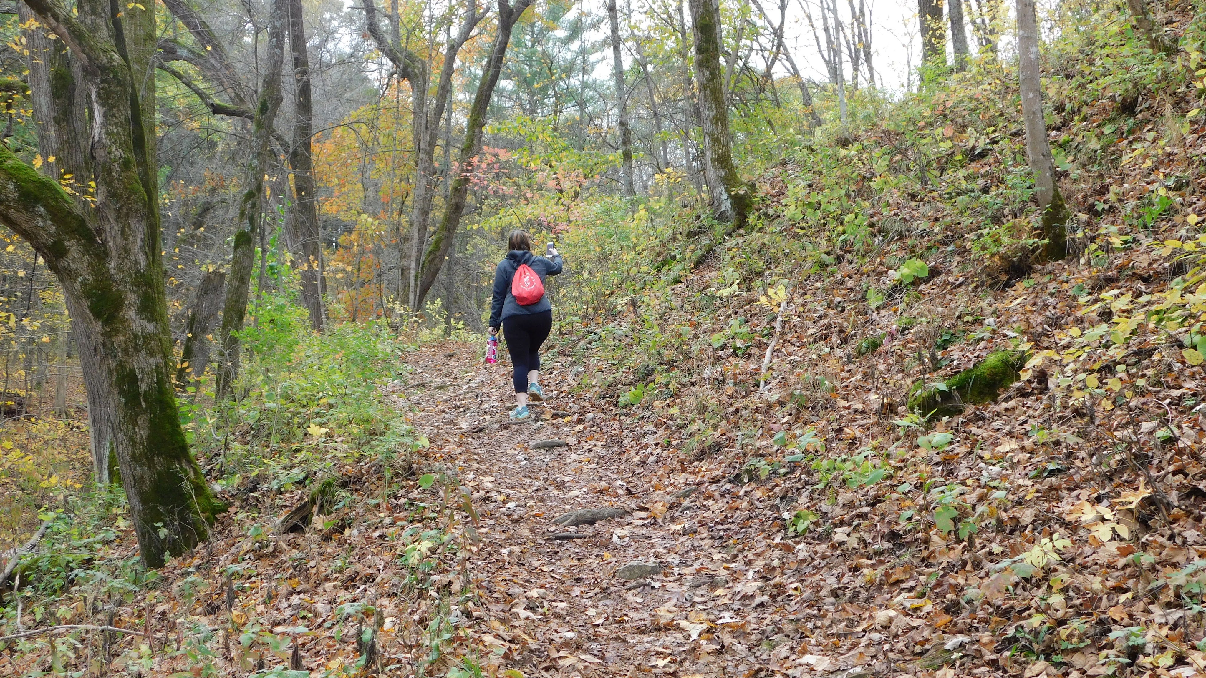
The first path we did was the River Route Nature Trail. It was a mile long path onto the wooded cliffs that run along the river. The app we use has this trail listed as moderate, and it definitely is tough if you are not used to hills. We cannot overstate this, don’t underestimate this park just because it is small.


The forest was very pretty and serene. The trees were all a golden yellow, and the path was covered in leaves. Most of the parks in Illinois have forested areas, but this one in particular somehow felt more forested. It’s hard to explain, but both of us felt this way. It was probably because we were the only people we saw out on the trail, and there was less evidence of people being around before us. The few structures built to make access easier were all old and weathered. In fact we couldn’t go the full mile because we would’ve had to cross a bridge that looked like it needed repairs.


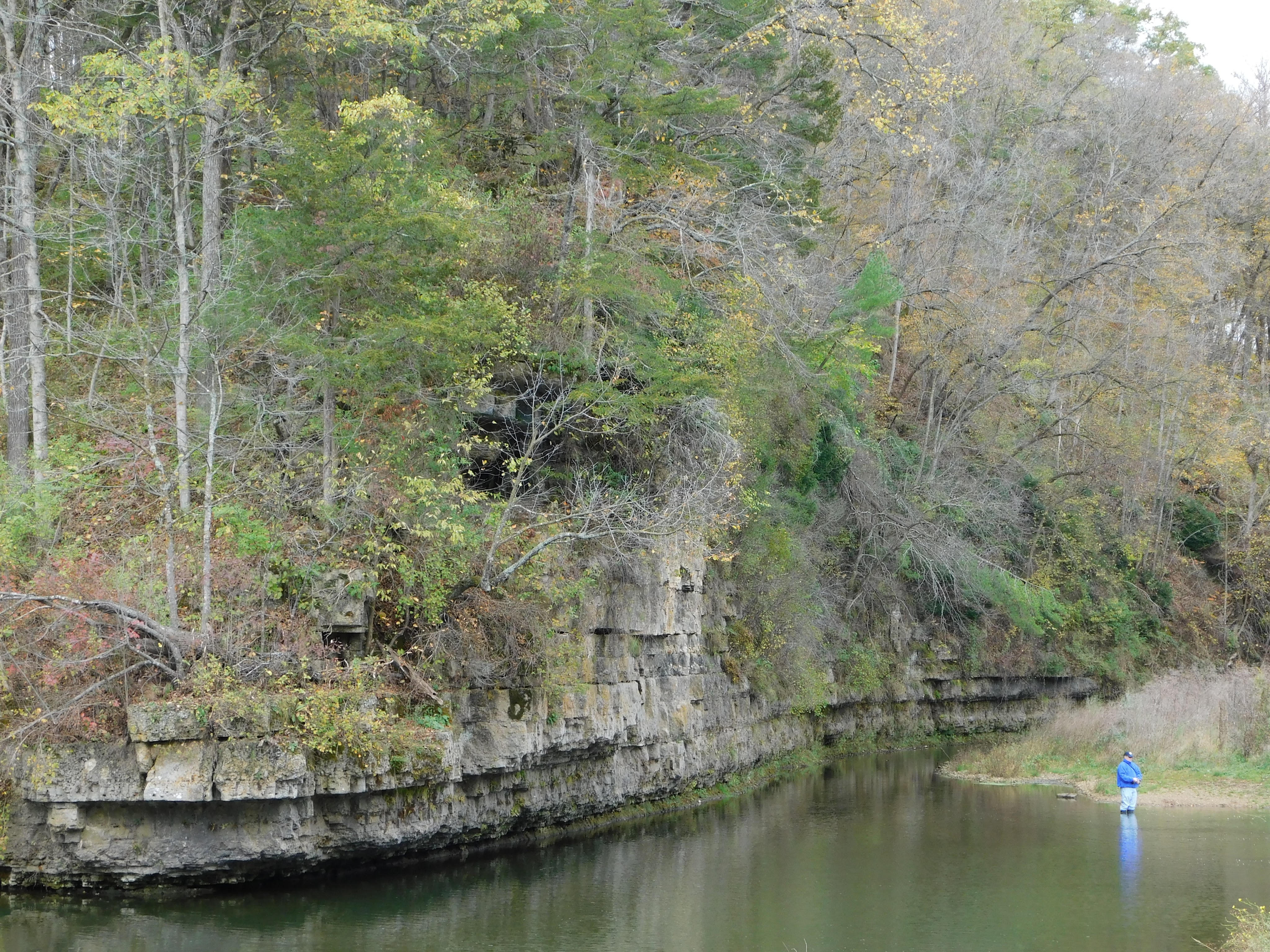
Coming back down the hill, we explored the area at the bottom of the canyon for a little bit. This was easily the most crowded area, with 5 people all wading in the river to fish. The entire park is centered around this area, with a few picnic pavilions and easy trail access. If you wanted to enjoy a quiet afternoon outside, you could sit by the river with a book, or a knitting project, or a friend and have a nice time, no hiking required. There are so few people this would be well worth it.
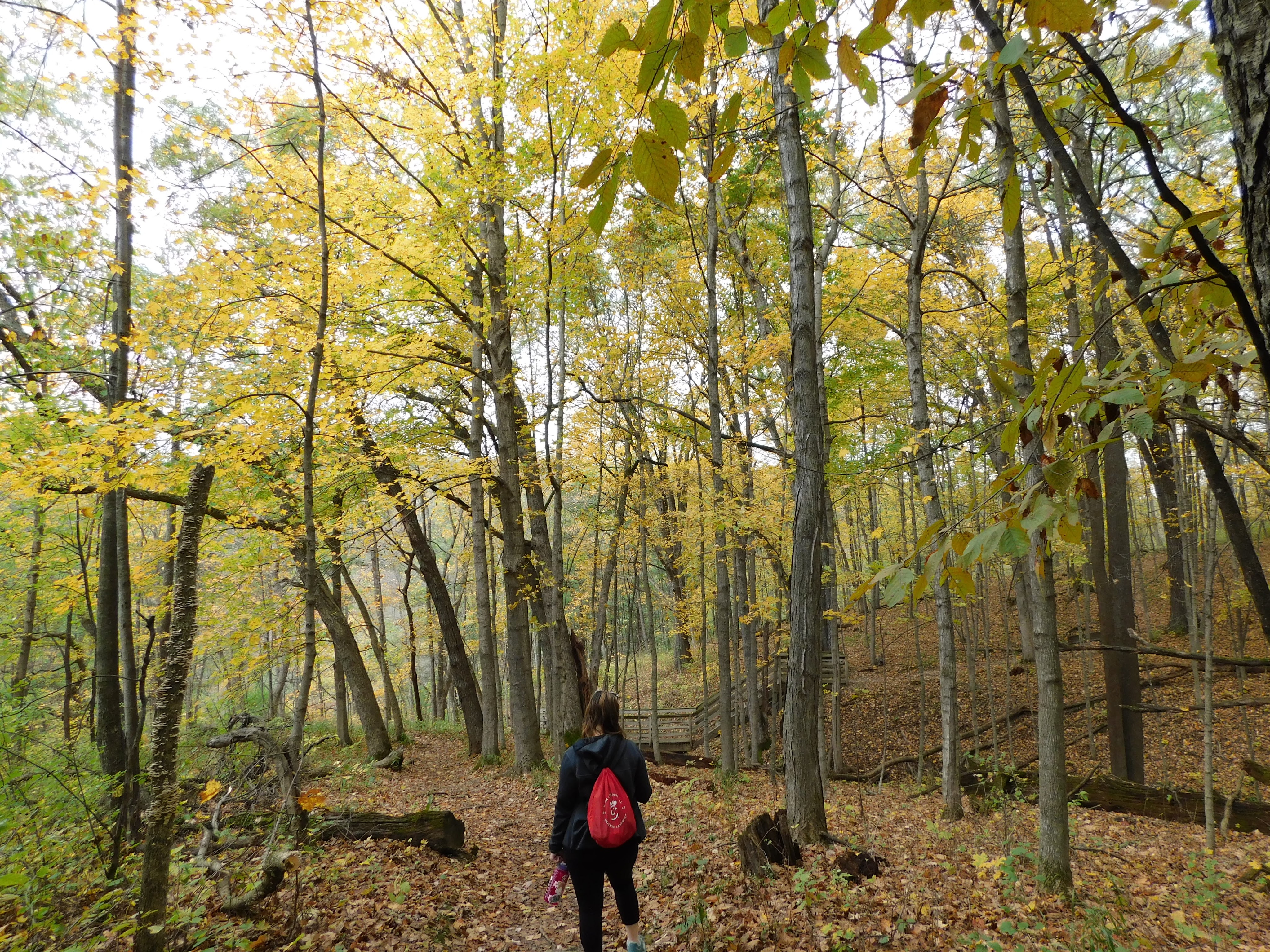
We decided to do one more trail before leaving, in order to see more of the park. Pine Ridge Nature Trail is the only one rated as easy in ARCSP, so that is the one we did. Compared to the rest within the park it is easy, but that rating would be closer to a moderate by what we’re used to. This trail was not as uneven or as covered in leaves to the same extent of the first trail, so it was much better defined. It looped around for 3/4 of a mile, through a combination of evergreen and deciduous trees. Part of the reason there were less leaves was because there were more pine needles instead. This path got an easy rating because the path is more even, but it is still very hilly and tough to climb. But it’s relative easiness led it to be the only trail where we saw anyone else walking at all, a couple with their dog.


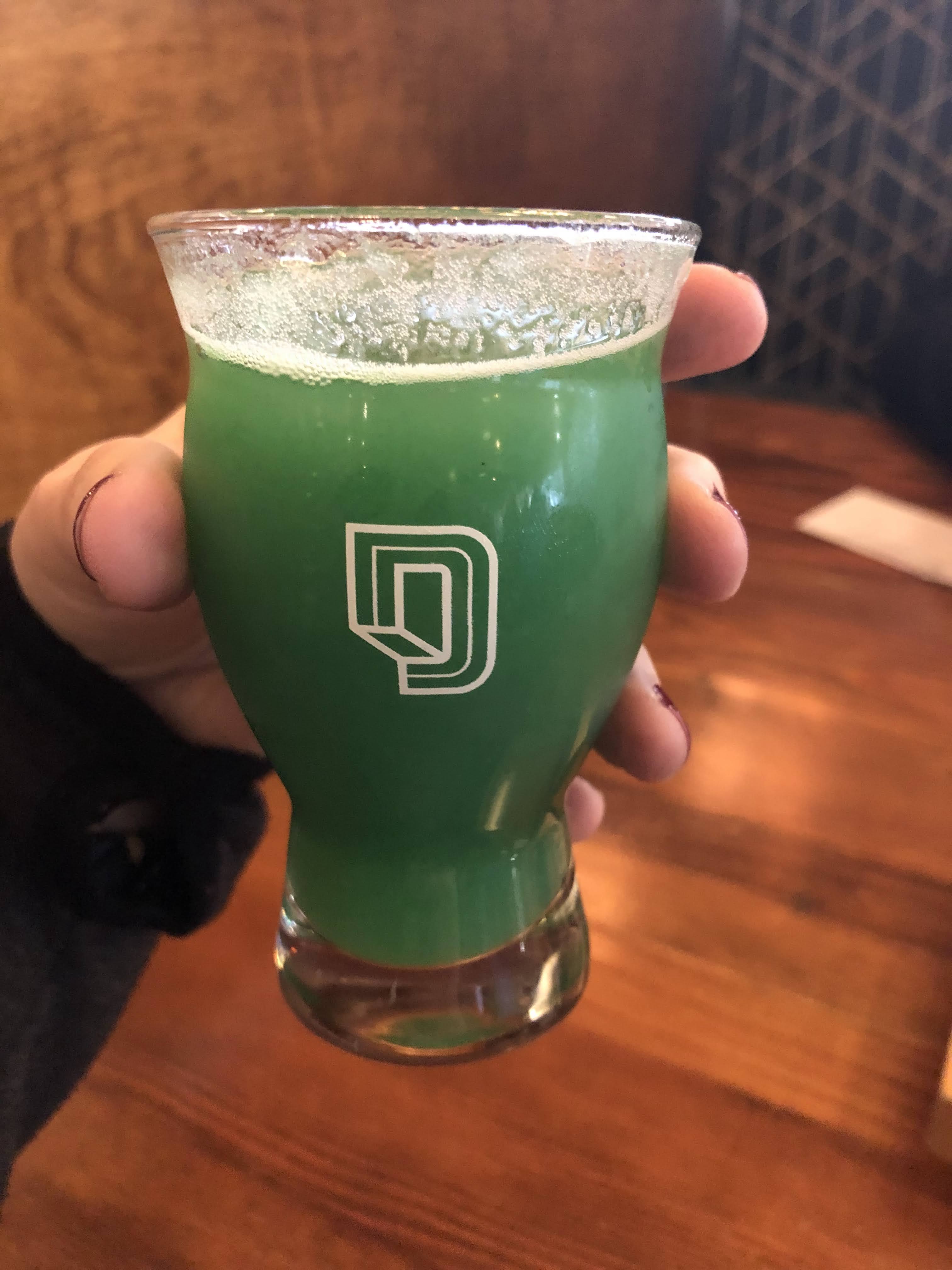
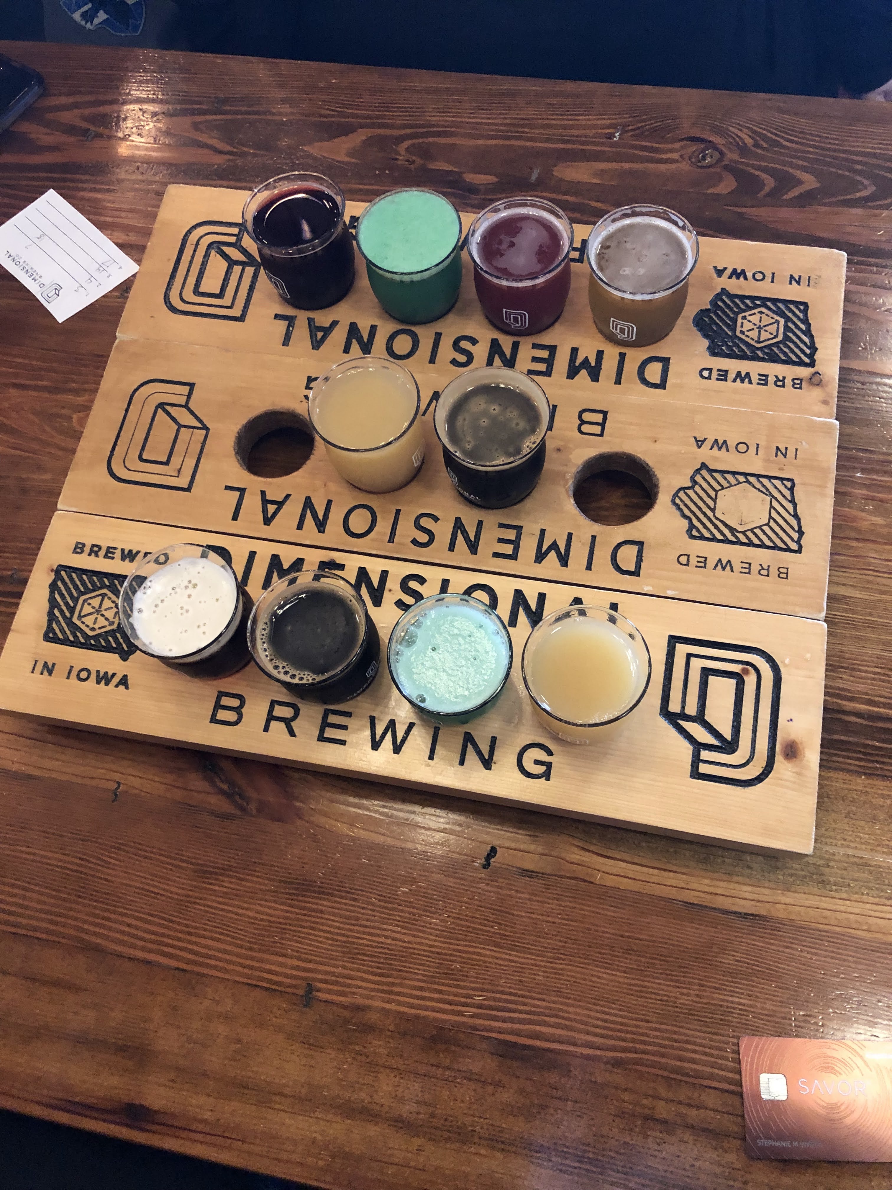
After finishing, we crossed state lines and drove to Dimensional Brewing in Dubuque, IA. This was one of the places we went on our previous trip, and we were so impressed, we knew we would have to go back and talk about it. They do a lot of unique brews with fun names, and they’re constantly releasing new ones. Whatever your style preference, they will have something. One was a seasonal sour with pineapple and blue raspberry flavors, combined to make the beer green. It was definitely a gimmick, but it was still an unexpected and nostalgic flavor profile. We have not had anything bad here, and would highly recommend going.

Day 1 of our trip was very fun, even with the long drives and the tough hikes. We only walked about 2.5 miles, but the elevation made it so we walked the equivalent of 41 flights of stairs. If you are not from the area, it probably is not worth driving two or more hours just to come here. However if you are going to Galena anyway, or if you are from the area it is definitely worth it to get outside and escape the crowds that are always on main street.

Leave a comment